
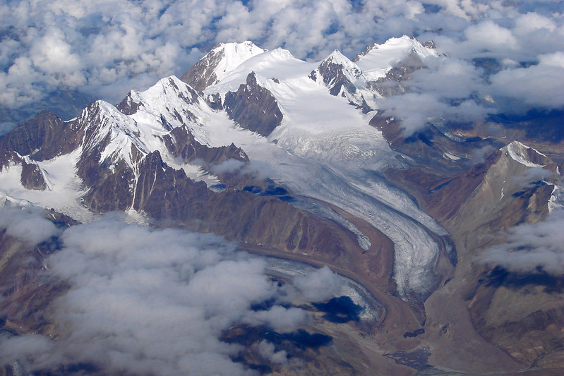

Globally, about 1 billion people live near glaciers and depend on glacial water. As temperatures continue to climb due to global warming, glaciers can become unstable and hazardous to nearby communities. These communities risk exposure to a series of linked processes, like ice collapse, flooding, and landslides, which could have life-threatening consequences. Scientists call these events catastrophic glacier hazard chains, or CGHC. So, a team of scientists in China sought to understand the driving forces behind these dangerous phenomena.
The team focused on a CGHC event that occurred in 2018 at the Sedongpu Glacier, located in the Eastern Himalayas. During this event, the glacier obstructed the flow of 30 million square meters (more than 300 million square feet) of the Yarlung Tsanpo River, one of the main rivers within the region.
To reconstruct the event, the team observed satellite images of the Sedongpu glacier over time, using a process called remote sensing. They used the images to calculate ice volumes, glacier velocities, and glacier movement between 1961 and 2018, to determine the glacier’s long-term physical properties and how they changed over time. They found that from 1968 to 2013, the Sedongpu Glacier shrank, or retreated, by over 6 football fields. It also lost ice and water volume and increased its velocity.
The scientists also measured earthquake waves on the Earth’s surface, or seismicity, to characterize any downslope rock or debris movements caused by the glacial retreat. They measured seismicity across 11 different seismic stations within 580 kilometers (about 350 miles) of the glacier. Then, they used this data to identify 2 distinct phases of the CGHC event on Sedongpu Glacier: the ice-rock avalanche and the debris flow.
When the ice-rock avalanche occurred, the team detected noticeable increases in seismicity, suggesting it lasted over 30 seconds. During those 30 seconds, over 8 million cubic meters (more than 280 million cubic feet) of ice fell onto the main glacier. The team recorded even more increases in seismicity during the debris flow, which lasted nearly 5 minutes. The debris from the avalanche hit the main valley glacier at nearly 300 kilometers (200 miles) per hour.
The researchers combined these data to describe how the 2018 CGHC event unfolded. First, the backward movement and shrinkage of the glacier produced an unstable sheet of ice hanging over a cliff face. The steep slope and large cracks in the ice caused an ice-rock avalanche. Debris from the avalanche then accumulated on the main glacier, causing it to move faster. As the main valley glacier moved downslope, it picked up even more debris from the bottom and sides of the glacial valley. The melting ice also increased the glacier’s velocity, and its movement eventually transitioned into a debris flow, which obstructed the Yarlung Tsangpo River.
In total, the CGHC event in the Sedongpu Glacier travelled over 10 kilometers (6 miles) and moved down in elevation for over 3 kilometers (about 2 miles) at a velocity of about 100 kilometers (about 70 miles) per hour. The glacier accumulated enough debris and ice to fill thousands of Olympic-sized swimming pools. Imagine what this could do to a nearby village!
It’s difficult for scientists to estimate when CGHC events will occur, but this team proposed several factors that could help predict them. These factors included the size of the ice-rock avalanche and the glacier velocity, as well as the occurrence of earthquakes, temperature changes, and the melting of the glacier’s underside. They stated that these factors can combine to create a domino effect that drives the CGHC process. They recommended consistent glacial monitoring as temperatures continue to climb, in the Himalayas and globally.
The team concluded that understanding CGHC events can help scientists mitigate glacial hazards and keep people safe, especially in mountainous areas such as the Eastern Himalayas. They stated that their findings illustrate the dangerous processes behind glacial melting, but further research is needed to accurately assess those processes and ensure nearby communities remain safe.
